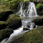
The glorious natural beauty of Loch Lomond and the Trossachs has inspired poets and writers for centuries.
MORE FROM SCOTLAND MAGAZINE
Loch Lomond and The Trossachs National Park embraces some of the most spectacular scenery in western and central Scotland. The Park, which was established by the Scottish Government in 2002, was the first in the country, followed by the Cairngorms National Park in 2003.
Overall, Loch Lomond and The Trossachs is the fourth-largest park in Britain, covering 720 square miles of land, with a 220 mile-long boundary. It includes two national nature reserves: Loch Lomond National Nature Reserve and The Great Trossachs Forest National Nature Reserve, plus Argyll Forest Park and Queen Elizabeth Forest Park.
The park is home to no fewer than 21 Munros (mountains over 3,000 feet in height), most famously Ben Lomond, Ben More and Ben Vorlich, along with 20 Corbetts (mountains between 2,500 and 3,000 feet high).
From a geological perspective, the National Park is split into Lowland and Highland areas by the Highland Boundary Fault, which runs across Loch Lomond itself. Varying geology and soil types mean that the Lowland area tends to comprise cultivated agricultural land, while the Highlands to the north are altogether more mountainous.
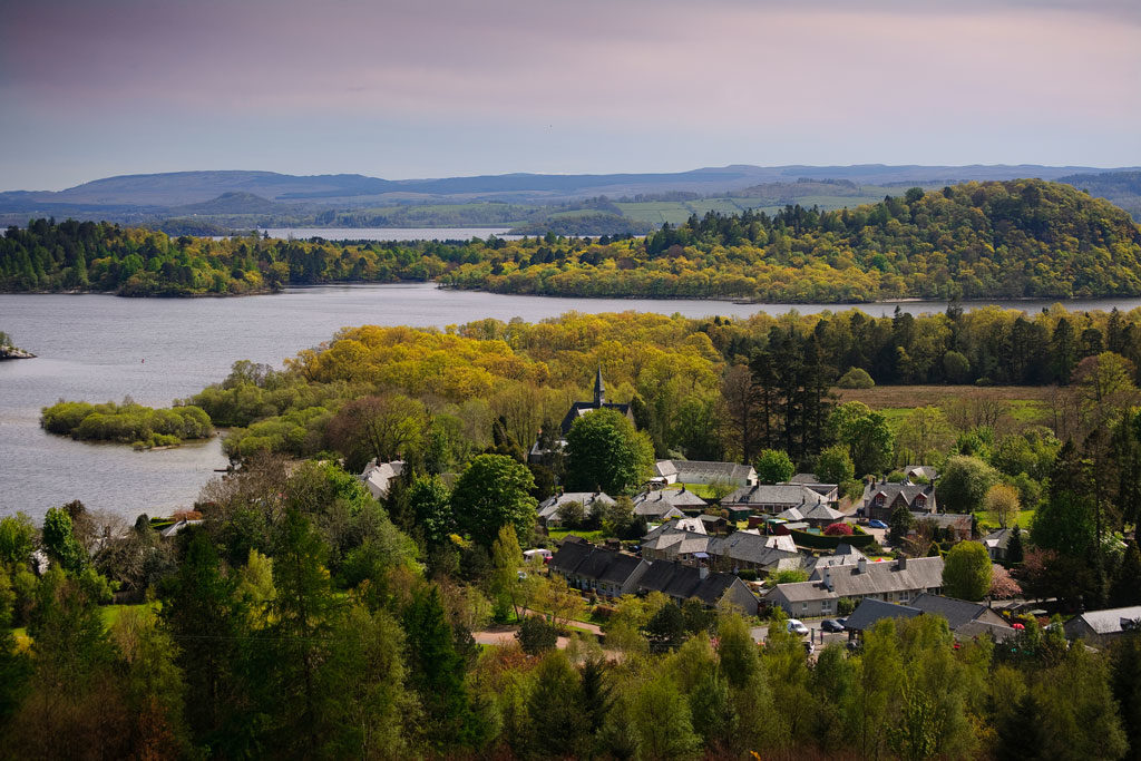
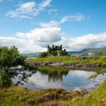
At the heart of the National Park is Loch Lomond itself – one of Scotland’s greatest natural assets, celebrated in legend and song. The name derives from the Gaelic for ‘Lake of the Elms.’ It is the freshwater lake or loch with the largest surface area in Britain, covering 27.5 square miles and measuring 22.6 miles in length. It is 0.62 to 4.97 miles in width and is over 500 feet deep in places.
The loch contains 22 named islands and the largest of these is Inchmurrin. Several of the islands are celebrated in the names of whisky expressions produced by Loch Lomond distillery in nearby Alexandria. Loch Lomond also features in one of the best-known traditional Scottish songs the world over – The Bonnie Banks o’ Loch Lomond, first published in 1841 in Vocal Melodies of Scotland.
Given that the southern shores of the loch are just 25 miles north of Glasgow city centre, it is hardly surprising that Loch Lomond, and by extension the whole National Park, is extremely popular, whatever the season.
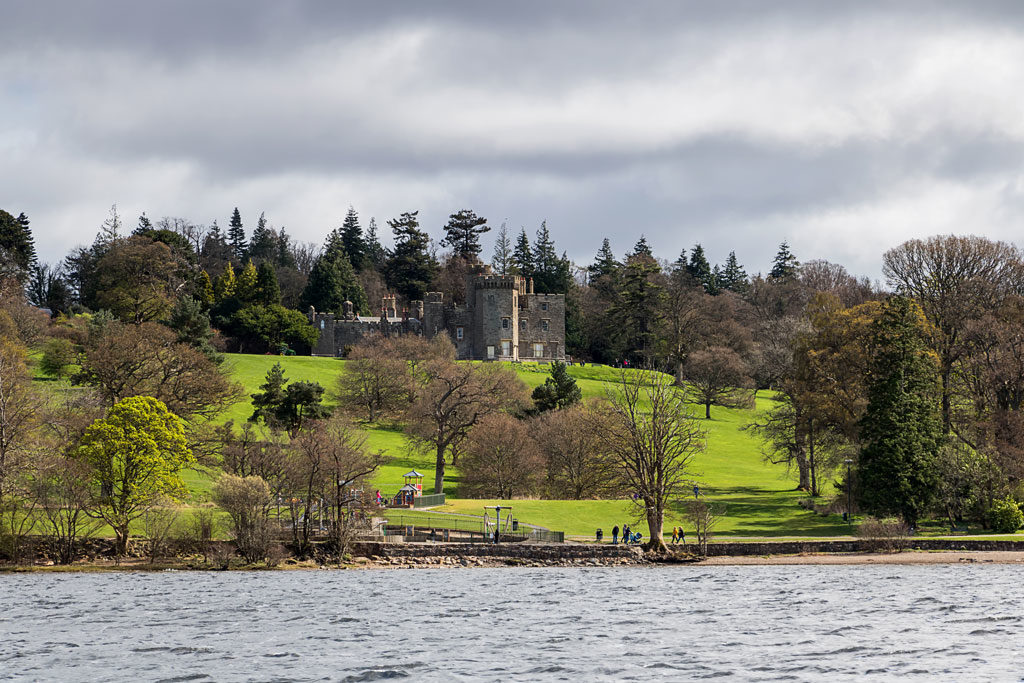
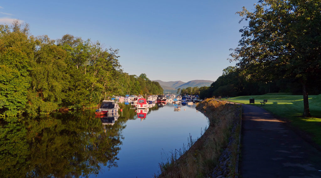
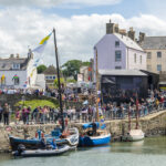
Entering the park from the south, the first settlement of significance is Balloch, located where the River Leven leaves the Loch Lomond to join the River Clyde at Dumbarton. Balloch is notable as the most popular place to berth boats on the loch.
In 1850 the railway reached Balloch, and extended to the Lochside pier. At that time, many steamers plied their trade on the water. The last paddle steamer made in Britain, The Maid of The Loch, is currently being restored to seaworthiness at Balloch, after sailing on Loch Lomond for 29 years.
Balloch is home to the National Park Gateway Centre and Loch Lomond Shores – an upmarket shopping mall with cafes and bars – which surely has one of the best views of any retail experience in Britain.
Following the western side of the loch along the A82, the conservation village of Luss is now bypassed. This ancient settlement is a popular stopping-off place with visitors. Those readers of a certain age may remember the long-running Scottish TV soap opera Take The High Road, which was largely filmed in Luss.
For those preferring a slightly more tranquil proximity to the loch, the B837 along the eastern shores passes through the village of Balmaha, home to a visitor centre for the Queen Elizabeth Forest Park and a 150-year-old boat-building business which runs ferry services to some of the loch’s inhabited islands.
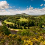
The National Park Authority divides the Park into four distinct areas: Loch Lomond, The Trossachs, Breadalbane and Cowal. According to the national tourism agency Visit Scotland, “Trossachs” is a unique word, for a unique place. It refers to the romantic area of sparkling lochs, crumpled hills, sleepy forests and welcoming villages east of Loch Lomond and west of Stirling.
The largest settlement in The Trossachs is Callander, founded in Roman times, and popular with tourists since the late 18th century. In fact, the local minister James Robertson wrote what is considered to be one of the first tourist guides in Scotland. The guide, entitled A Pamphlet Descriptive of the Neighbourhood of Callander, was published in 1790.
Writers such as Samuel Taylor Coleridge and brother and sister William and Dorothy Wordsworth visited Callander and the surrounding area, with the latter going on to record her experience in Recollections of a Tour Made in Scotland: 1803.
This was the first of three trips made by the trio to Scotland, and it inspired a number of poems by William Wordsworth, including To a Highland Girl (at Inversnaid), Stepping Westward (along Loch Katrine), The Solitary Reaper (at Balquhidder), and Rob Roy’s Grave (by Loch Katrine), though the famous outlaw clansman is actually buried at Balquhidder and not by Loch Katrine.
Topographically, The Trossachs were not unlike the Wordsworths’ native Lake District, and just as the Lake District was being ‘discovered’ by visitors during the early 19th century, so were Loch Lomond and The Trossachs.
Later literary visitors to what is now the National Park included the novelists Charles Dickens (1841) and George Eliot (1845), not to mention Hans Christian Anderson (1847) and the French writer Jules Verne. Following his visit in 1859, Verne – best known for Around the World in Eighty Days and Twenty Thousand Leagues Under the Sea – went on to write a somewhat bizarre novel which featured a group of miners who established a settlement below Loch Katrine. The poet Gerald Manley Hopkins also spent time in the area during 1881.
The Cult of the Picturesque, as it became known, brought not only tourists and writers, but also painters such as Alexander Nasmyth, whose sometimes fanciful depictions of its scenery were sold in large quantities as prints to those keen to own an image of the area.
The Trossachs became a true tourist magnet after the publication of Walter Scott’s epic poem The Lady of the Lake, which featured Loch Katrine, in 1810.
Currently undergoing repairs, the steamship Sir Walter Scott has spent no fewer than 118 years in service. Scott’s poem was a bestseller, and when The Dunblane, Doune and Callander Railway reached Callander in 1858, it increased the town’s popularity as a centre for exploration of ‘the picturesque’.
Walter Scott had long been fascinated by the figure of Rob Roy MacGregor, Highland freebooter, cattle thief and blackmailer, who lived from 1671 to 1734. While apprenticed in his father’s law office – around 1790 – Scott received first-hand accounts of Rob Roy from a Highland client of the firm who had known him personally.
On one occasion he delivered legal documents to a potentially dangerous client in Balquhidder, an expedition requiring the backup of six soldiers and a sergeant from Stirling Castle.
The sergeant was very familiar with the area, and provided Scott with more anecdotes about Rob Roy.
Following the success of The Lady of the Lake, Scott returned to this part of Scotland with his 1817 historical novel Rob Roy, in which the legendary outlaw was portrayed as something of a Robin Hood figure. Scott was always thorough in his research and went so far as to visit Rob Roy’s cave near Inversnaid.
Today, the 79-mile-long Rob Roy Way runs from from Drymen in Stirlingshire to Pitlochry in Perthshire, utilising roads and tracks that would have been familiar to Rob Roy in his day.
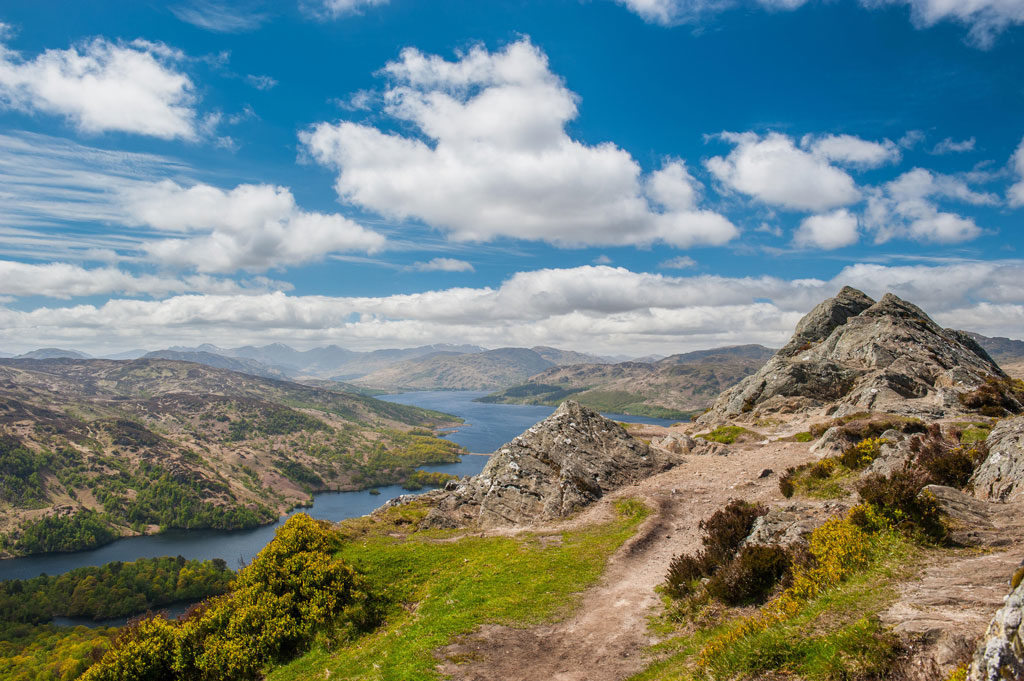
Less than a dozen miles west of Callander is the picturesque village of Aberfoyle, which serves as an important gateway for people visiting The Trossachs. Loch Ard, Loch Chon, Loch Arklet and Loch Lomond lie to the west of Aberfoyle with Loch Katrine, Loch Achray and Loch Venacher to the north.
Scotland’s only lake, the Lake of Menteith, is situated to the east and, in contrast with some of the rugged Highland glens of the National Park, the Lake of Menteith is positively lowland in nature. It is surrounded by fertile farmland and woodlands and is well-known for its trout fishing and over-wintering colonies of geese.The ruined Augustinian priory of Inchmahome is located on an island in the lake and may be visited by ferry during the summer months.
Breadalbane formed one of the traditional provinces of Scotland, and was historically a stronghold of Clan Campbell, one of the most powerful and influential of all the Scottish clans. During the mid-19th century, local government reforms placed Breadalbane within the newly-created county of Perthshire.
The village of Crianlarich is strategically the most important in the area, with two military roads converging there in the 1750s. Today, the busy A82 from Glasgow to Inverness via Fort William, and the A85 from Perth to Oban follow the lines of the old military roads quite closely. Crianlarich is a bustling place despite the junction of the A82 and A85 – formerly in the centre of the village – being replaced in 2014 by a new bypass.
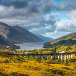
Crianlarich is also significant for rail users, with the first of two stations being established there in 1873. Today, only one survives and, as a stop on the West Highland Line from Glasgow, it is the place where the line divides, with trains heading either to Oban or Fort William.
The A85 east to west runs along the northern shores of Loch Earn, passing through St Fillans and Lochearnhead. Both villages became popular tourist destinations after a railway line from Crieff to Lochearhead was set up in 1904. Today, Loch Earn is popular for water sports.
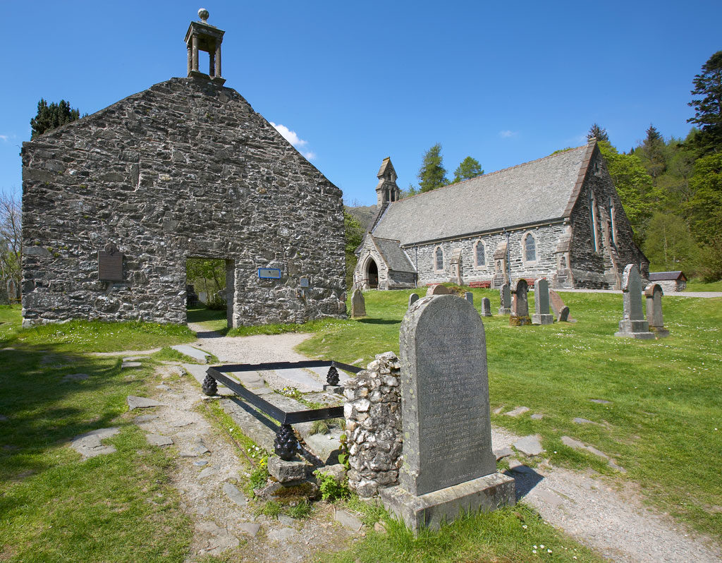
South-west of Lochearnhead is the small village of Balquhidder, most notable for its associations with Rob Roy MacGregor. MacGregor, who lived at Inverlochlarig, Balquhidder, waged a feud against his creditor the Duke of Montrose after the duke seized his lands in 1712. MacGregor was subsequently imprisoned, but was pardoned in 1727, just as he was about to be transported to Barbados. He died at Inverlochlarig in December 1734 and was buried in the local churchyard where his wife and two sons also lie. His gravestone reads “MacGregor despite them.”
The pretty village of Killin lies north-west of Lochearnhead, close to the western shores of Loch Tay. Until 1965 the Killin Railway ran right up to a pier on the loch side where visitors could board a steamer tour. However, the steamer service ended with the outbreak of the Second World War in 1939. A key attraction at Killin is the spectacular Falls of Dochart, located close to the village centre, which offers a wide range of places to eat, drink, shop and stay.
The Clan MacNab Burial Ground is situated on a small island called Innis Bhuidhe in the middle of the Dochart River, and is accessible via the Dochart Bridge. The burial ground dates from the late 18th century and includes the graves of nine clan chiefs, while a medieval slab supports the theory that much earlier burials had also taken place there. Killin’s ancient roots are further confirmed by a font, apparently dating back to the very early Christian era, which is located within the 18th century Church of Scotland.
Some five miles north-west of Crianlarich via the A82 is another busy Breadalbane village called Tyndrum, where the A82 and the A85 converge, with the former leading north to Fort William, while the latter turns west to Oban.
Tyndrum’s early history was as a stopping-off place for drovers taking cattle and sheep to markets in central Scotland and today it continues to cater for weary travellers with hotels, restaurants and shops. One stand-out business is the Green Welly Stop, still owned by members of the Gosden family who established it in 1969. The Stop sells everything from a sandwich to midge repellent (recommended for the West Highlands in summer) and from green wellies to a pair of tartan lounge pants. Additionally, it’s regarded as one of Scotland’s leading whisky specialist outlets.
As well as being at the junction of two roads, Tyndrum also boasts two railway stations and even two railway lines, with one passing through Lower Tyndrum Station, linking Glasgow with Oban, while the line at Upper Tyndrum station serves Fort William and Mallaig.
The fourth area of the Loch Lomond and The Trossachs National Park is Cowal. The Cowal Peninsula extends into the Firth of Clyde and is framed by Loch Long to the east and Loch Fyne to the west. It is readily accessible from Glasgow by ferry via Gourock to Dunoon, making it popular for day trippers.
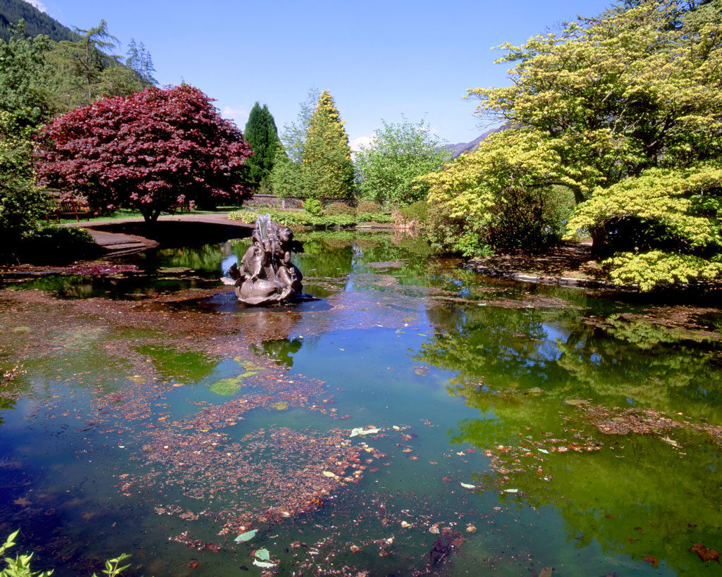
Established in 1935, Argyll Forest Park is Britain’s oldest forest park and it offers a great mix of scenery, including mountains and sea lochs, while Benmore Botanic Garden extends to 120 acres in a mountainside location, boasting 150-year-old giant redwoods and more than 300 species of rhododendron.
The village of Kilmun, located on the shores of the Holy Loch, was a monastic community in the 17th century and later became the ‘spiritual home’ of Clan Campbell during the mid-15th century. The Argyll Mausoleum, adjacent to Kilmun Church, dates from 1790 and was constructed to house the bodies of the Dukes and Earls of Argyll, chiefs of Clan Campbell, and their families.
Located at the head of Loch Long, Arrochar is just a mile and a half west of Tarbet on the shores of Loch Lomond. During Viking times, a valley between the two settlements was used to haul boats between the sea and the inland loch.
In the great age of steamers the Three Lochs Tour was popular with folk from Glasgow and the surrounding areas. It left the River Clyde for Loch Goil before venturing up Loch Long to Arrochar. From there, passengers were taken by carriage to Tarbet and then boarded another steamer down Loch Lomond.
The mountains to the west of Arrochar are popularly known as the Arrochar Alps and have long been favoured by hill walkers and climbers. The distinctive ‘Cobbler’ (or Ben Arthur) is a notably popular climb.
A dozen miles west of Arrochar is Lochgoilhead, which is located in spectacular scenery at the northern end of Loch Goil and can only be reached by single track roads. This in no way diminishes its popularity with visitors and, at peak tourist times, the village virtually doubles in population.
It is not difficult to understand the huge appeal of Loch Lomond and The Trossachs National Park, particularly given its location. Within around a half hour’s drive from the middle of Scotland’s largest and busiest city it is possible to be transported into an apparently totally different country. And in this busy day and age everyone needs transporting away from their everyday lives from time to time.
MORE FROM SCOTLAND MAGAZINE
SCOTLAND MAGAZINE
Published six times a year, every issue of Scotland showcases its stunning landscapes and natural beauty, and delves deep into Scottish history. From mysterious clans and famous Scots (both past and present), to the hidden histories of the country’s greatest castles and houses, Scotland‘s pages brim with the soul and secrets of the country.
Scotland magazine captures the spirit of this wild and wonderful nation, explores its history and heritage and recommends great places to visit, so you feel at home here, wherever you are in the world.