This intriguing group of steep and rocky mountains is made for exploring, says Keith Fergus.
MORE FROM SCOTLAND MAGAZINE
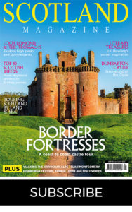
All hillwalkers have that one special mountain peak or range where their love affair with the outdoors began. For me it was the Arrochar Alps; the ragged, jagged jumble of summits that vie for attention towards the western edge of the Loch Lomond and The Trossachs National Park.
READ MORE: Loch Lomond and the Trossachs
Although not underrated the Arrochar Alps are seen, by some, as a poorer cousin to the nearby iconic pinnacles of Glencoe or Lochaber. Yet due to their proximity to Scotland’s Central Belt, and the fact that they rise straight from the roadside, the Arrochar Alps provide many with their first steps onto the hills.
A huge choice of routes includes the classic Munros of Beinn Narnain, the retiring but view-laden Corbett of Ben Donichand, of course, the mighty Cobbler.
Yet for a real mountain experience, a magnificent round of seven of the Arrochar Alps can be bagged in one, albeit long, tough day with around 13,000 feet of ascent and 25 miles in distance. However some of the finest vistas on Scotland are your reward for the climb.
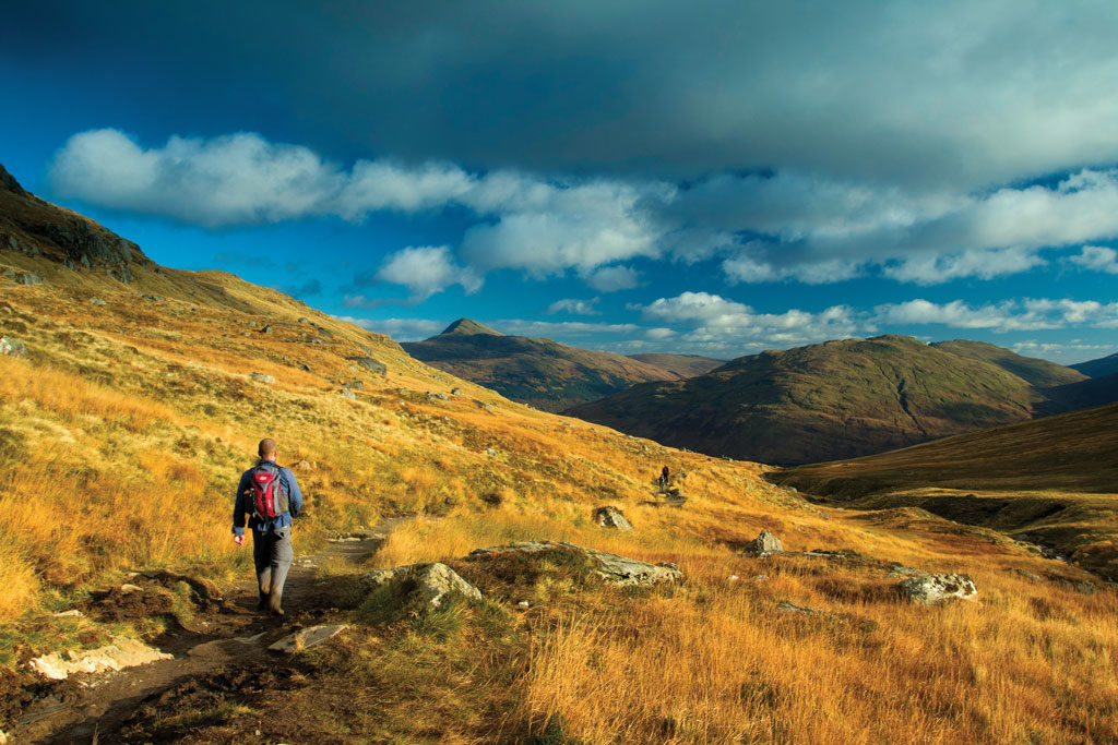
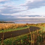
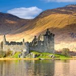
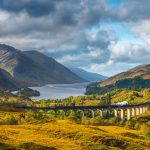
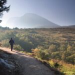
The best starting point is the bustling village of Arrochar beside the fjord-like Loch Long. The loch’s name has nothing to do with its length (although it does extend for some 20 miles) but instead means Loch of Ships; this may relate to the boats that once navigated their way inland from the sea. From here a steep climb rises through the Argyll Forest Park soon leading above the tree line from where that first breathtaking view of Ben Arthur, better known as The Cobbler, opens out. It really is an extraordinary mountain, its triumvirate of peaks quite unlike anything else in the British Isles.
The good path then pushes on past the enormous Narnain Boulders. These two distinctive glacial erratics give a clue to the momentous geological events that helped form this topographical masterpiece. They also, along with many of the Arrochar Alps, played a central role in the great outdoor movement of the 1930s.
Men and women, looking to escape the noisy and filthy industrial backdrop of Glasgow, would head north after finishing work on a Saturday to spend Sunday climbing the Arrochar and camp beneath the Narnain Boulders. Away from the sweat and toil of the working week, the clean air, sense of space and mountains must have been akin to finding the Holy Grail.
Beyond the two boulders the path rises to the Bealach a’ Mhaim, from where it glides up the steep, craggy north ridge of The Cobbler, onto its 2,900-foot summit, although topping out means threading the infamous eye of the needle. Once through the human-sized hole, which leads onto an exposed ledge about one-metre wide with a sheer drop of well over 30 metres on one side, the final feat is understandably a little too vertigo-inducing for some.
Many are happy to simply explore the summit plateau, in particular the mountain’s North Peak from where the panorama is extraordinary. To the east the alluring complexity of Ben Cruachan’s profile is prominent while south, some 60 miles away, Ailsa Craig, a lump of rock sitting out in the Firth of Clyde, looks close enough to touch.
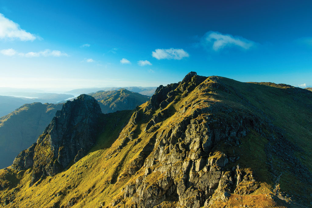
Descending back to the Bealach a’ Mhaim a steep climb rises onto Beinn Narnain. The path skirts the southern edge of the mountain and it’s only as you approach the 3,038-feet top that the true extent of the summit spectacle comes into view. A fabulous vista extends along the length of Loch Lomond to Ben Lomond.
It is then back to the Bealach a’ Mhaim for a final time after which a sometimes boggy path leads onto the 3,317-foot top of Beinn Ime, the highest point of the Arrochar Alps and where Ben Lomond, Beinn an Lochain, Ben Cruachan, Ben More on Mull and a litany of other mountains are visible.
Now the walking becomes a little tougher, with many steeper slopes and pathless terrain lying ahead. A descent of a couple of hundred metres before a rise across rougher ground (a good place to potentially spot red deer and skylark) reaches the Corbett of Beinn Luibhean. From the top the outlook opens out to Beinn an Lochain, the next port of call, its seemingly impenetrable tiered slopes rising vertiginously above the steely blue waters of little Loch Restil.
A messy descent soon reaches the wonderfully named Bealach an Easain Dubh, the pass of the black water. Here a steep path rises to the airy 2,956-foot crown of Beinn an Lochain, where a little care is required on a couple of relatively exposed sections. It might take a couple of tough hours to climb Beinn an Lochain, but again the effort is richly rewarded; the Paps of Jura, the peaks of Mull and the muscular mountains of Glen Coe stretch out into a seemingly endless view.
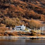
The most direct route to our next mountain is down the steep heather-clad southern slope of Beinn an Lochain all the way to the Rest and Be Thankful – and yes you will be grateful at this point. At 800-feet above sea level it is the highest point of the A83 and refers to the inscribed stone that was placed by soldiers when they completed the original military road, now known as the Drovers’ road, in 1753.
Therefore from this height it is a relatively pain-free climb all the way onto Ben Donich’s 2,779-foot apex. Sitting well back from the roadside Ben Donich has a slightly wilder air than the other Arrochar Alps and a clear path makes the going pretty simple. Ben Donich provides, for me, the finest outlook of all the Arrochar Alps with Beinn an Lochain looking like a mini Buachaille Etive Mor and The Cobbler taking on a whole different guise. When you reach here on a clear day the many islands of the Firth of Clyde, including Bute, Arran and Ailsa Craig, are all visible.
Energy levels will no doubt be low at this point but there is only one more peak to climb. As the crow flies, less than two miles separates Ben Donich from the knobbly outline of The Brack but walking there is a different matter entirely. Tussocky slopes drop reasonably easily to a bealach inbetween the two mountains, but beyond this, a sustained pull of over 1,100-feet in less than 0.46 miles, over steep pathless ground, will leave thighs burning (and perhaps sanity being questioned).
However, once you have been able to catch your breath The Brack bestows a final exquisite view with a whole host of beautiful lochs and mountains drawing the eye to the shimmering Firth of Clyde and the island of Arran’s serrated outline.
The final few miles of the route take place predominantly along the forest tracks of the Argyll Forest Park and once back in the village of Arrochar a number of eateries and pubs will grant the perfect way to reflect on this accessible epic.
MORE FROM SCOTLAND MAGAZINE
SCOTLAND MAGAZINE
Published six times a year, every issue of Scotland showcases its stunning landscapes and natural beauty, and delves deep into Scottish history. From mysterious clans and famous Scots (both past and present), to the hidden histories of the country’s greatest castles and houses, Scotland‘s pages brim with the soul and secrets of the country.
Scotland magazine captures the spirit of this wild and wonderful nation, explores its history and heritage and recommends great places to visit, so you feel at home here, wherever you are in the world.
